Living
2030 Goal: Our rivers as parks
Ross Barney Architects
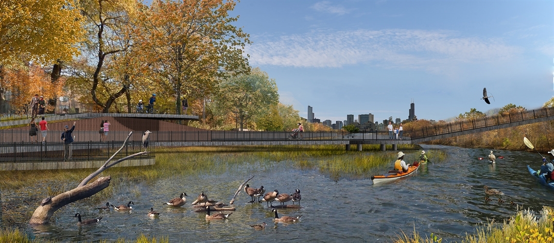
The east branch of the Chicago River around Goose Island isn't navigable for large boats and could be an in-river park for paddling and wildlife.
Chicago can develop an international reputation for creating parks in rivers.
Non-navigable sections of Chicago’s waterways—such as Bubbly Creek, the North Branch of the Chicago River east of Goose Island, the Grand Calumet River and portions of Lake Calumet—will be reimagined as instream parks by planting wetlands vegetation and restoring habitat in the water. These places can become hotspots for fishing, learning how to canoe and kayak in a safe environment, or even quietly meditating while surrounded by nature.
“Why do all of our parks have to be on land? Why can’t the river be the park?”
—Nick Wesley, Urban Rivers
Native wetland vegetation will have the added benefits of helping clean the water, prevent erosion, and nurture populations of fish, otters and other wildlife. In areas such as the Grand Calumet River or Lake Calumet, these instream parks will connect to restored ecosystems managed by the Ill. Dept. of Natural Resources, Forest Preserves of Cook County and State of Indiana.
Likewise, we will transform neglected shorelines and man-made river walls—where feasible—into thriving habitats that connect land and water ecosystems. From crumbling sheet pile riverwalls to the river edges of Chicago Park District and Forest Preserves of Cook County properties—notably the latter’s multiple riverfront golf courses—wholesale reimagination and redevelopment of the river edge will dramatically change the relationship between Chicago and its rivers.
Ross Barney Architects
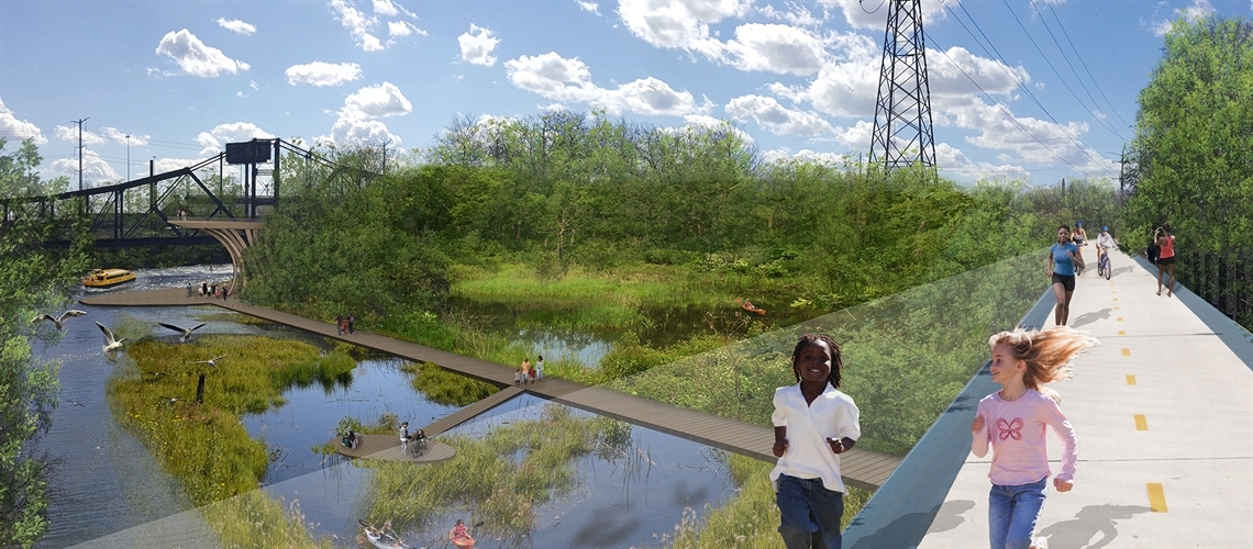
The Collateral Channel has the potential to become a natural asset and a major hub on a new south riverfront trail.
Making it happen
- Fast track the removal of the River Park dam to improve fish and paddling passage up the North Branch of the Chicago River.
- Support remediation of Bubbly Creek by the U.S. and Ill. Environmental Protection agencies, U.S. Army Corps of Engineers and legacy polluters.
- Assess the feasibility of developing instream wetlands in areas such as the Collateral Channel, Grand Calumet River, northwestern Lake Calumet and North Branch Canal.
- Pilot instream wetlands in one or more locations, to better understand plant health, water quality and flow effects, maintenance needs and more.
- Conduct an updated study of river wall conditions, and suitability of habitat restoration through river wall reconstruction or naturalization.
- Assess possible public, private and hybrid management scenarios for instream parks.
- Assess the feasibility of redesigning river edges of golf courses and other recreational areas.
- Reassess the feasibility of previously proposed habitat projects that have not been completed such as those identified within the 2005 “Chicago River Agenda” and MWRD’s 2010 “Habitat Evaluation and Improvement Study.”
Key players
U.S. Army Corps of Engineers, Chicago Park District, Park Advisory Councils and local stewardship groups, Forest Preserves of Cook County, Friends of the Chicago River, Field Museum, Shedd Aquarium, MWRD, paddling and rowing associations, Openlands, Ill. Dept. of Natural Resources, U.S. Environmental Protection Agency, Ill. Environmental Protection Agency, Chicago Parks Foundation
Back to goals