Inviting
2030 Goal: Easy access from all neighborhoods
Through strategic land acquisition, intergovernmental collaboration and new investments along our riverfronts, from downtown to the neighborhoods, residents and workers will see our rivers as part of their daily lives.
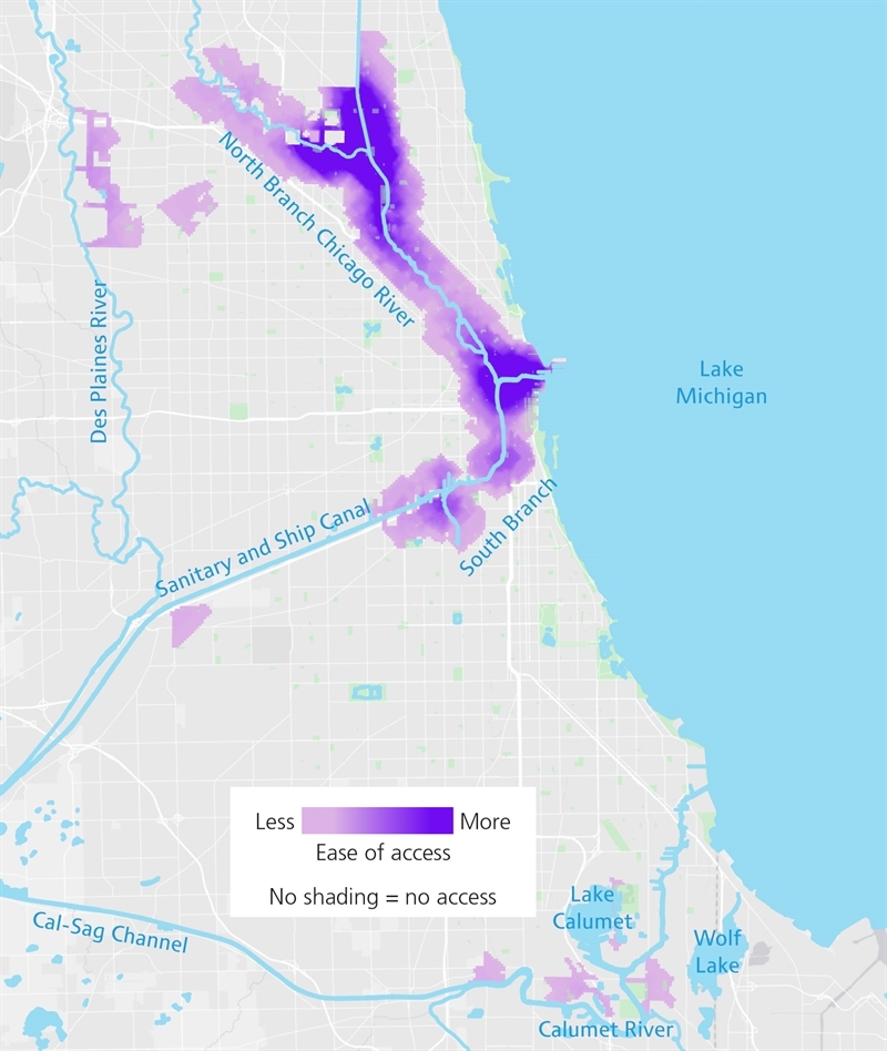
Downtown and many north side neighborhoods have easy access to the river (dark purple), while most of the South Branch, Calumet and Des Plaines remain difficult (light purple) or impossible (no shading) to access.
Thanks to new park spaces, public access points and recreational amenities, people will know where their nearest river access point is. As with the lakefront, the riverfront will attract thousands of people from around the Chicago region every day.
When people arrive at the rivers, they’ll have a variety of things to do, thanks to new trails and boat launches, concessions for watercraft rentals, picnic facilities, and regular programming for everything from fishing to paddling, provided by the Chicago Park District, Forest Preserves of Cook County and Ill. Dept. of Natural Resources. By programming river-related events throughout the city, rather than only downtown, transportation gaps will be reduced, inherently improving accessibility.
Making it happen
Conduct a thorough network assessment of sidewalks, streets, transit and riverfront trails to determine true accessibility of existing public space along the rivers, as well as gaps.
Key players
Mayor’s Office, Chicago Park District, Forest Preserves of Cook County, Chicago Dept. of Transportation, Mayor’s Office for People with Disabilities, Active Transportation Alliance, Chicago Dept. of Planning and Development, communities and community organizations
Our rivers, our role
Document barriers to river access at the neighborhood level—e.g., sidewalk conditions, lack of trail connections, missing signage, etc.
Back to goals