Living
2030 Goal: Expanded preserves and parks
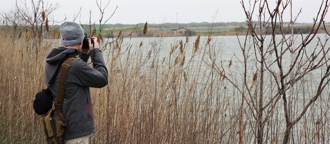
Unused land at the Illinois International Port District could be opened to the public as natural space for a variety of activities, including birdwatching.
Thousands of acres of riverfront land should be transferred to experienced land managers for restoration, remediation, conservation and stewardship.
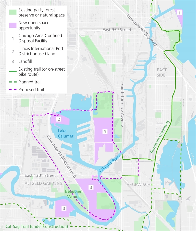
The Calumet area has a wealth of former industrial and other vacant sites that are good opportunities to expand open space.
These new riverfront open spaces will increase habitat and communities’ access to natural areas, improve air and water quality, and make better use of previously dormant land. Plus, they will help meet regional open space goals such as those defined by Forest Preserves of Cook County’s “Next Century Conservation Plan.”
Along both the Chicago and Calumet rivers, the most creative minds in landscape architecture, design, botany and urban planning should be engaged with community organizations and government to transform thousands of acres of marginal riverfront property. We will turn capped landfills, containment facilities for dredging materials, brownfields from past industry, rights of way for power lines and other utilities, public holdings and abandoned rail lines into productive habitats that enhance surrounding neighborhoods.
These are not the region’s most straightforward opportunities for expanding open space and natural areas. At the local level, however, they are often the only option if other land is to be preserved for job creation and employment. Building community and political support for these long-term investments will be easier with a concurrent increase in people actively participating in Park Advisory Councils and stewardship groups throughout the river system.
Making it happen
- Develop a master plan for the combined geography of Beaubien Woods, Altgeld Gardens and vacant land along 134th Street.
- Assess the current condition and viable future use of landfills along the Calumet River.
- Develop a site plan for the parcel owned by MWRD at the mouth of the Collateral Channel.
- Develop a site plan for recreational development on the southwestern bank of the Chicago River, opposite Goose Island.
- Initiate a visioning and planning process for the Chicago Area Confined Disposal Facility at the mouth of the Calumet River, a rare opportunity for a park destination that is both riverfront and lakefront.
- Expedite planning, remediation and development of DuSable Park at the mouth of the Chicago River, another park destination that is both riverfront and lakefront.
- Conduct an updated ownership and liability assessment for all land along the Chicago and Calumet rivers.
- Examine rail, power line and other privately held rights of way to determine feasibility for connections between new or existing open space.
Key players
U.S. Army Corps of Engineers, Chicago Park District, Park Advisory Councils and local stewardship groups, Forest Preserves of Cook County, Friends of the Chicago River, Field Museum, Shedd Aquarium, MWRD, Openlands, Ill. Dept. of Natural Resources, U.S. Environmental Protection Agency, Ill. Environmental Protection Agency, ComEd, private rail operators, landfill managers, Chicago Housing Authority, communities and community organizations
Our rivers, our role
- Encourage local leaders to transform vacant lots into open space and rally your neighbors to do the same.
- Volunteer to help restore and maintain open spaces, parks and community gardens.
Back to goals