Banking on Success: New York City's waterfront plan
October 20, 2015
, By MPC Director Josh Ellis and MPC Research Assistant Becky Clow
Flickr user Wally Gobetz (CC)
Banking on Success offers insights into other cities' plans to reimagine their rivers and waterfronts. As Great Rivers Chicago works with residents and researches long-term priorities for the Chicago, Calumet and Des Plaines rivers in the city, these case studies offer examples of challenges, successes, and lessons for Chicago.
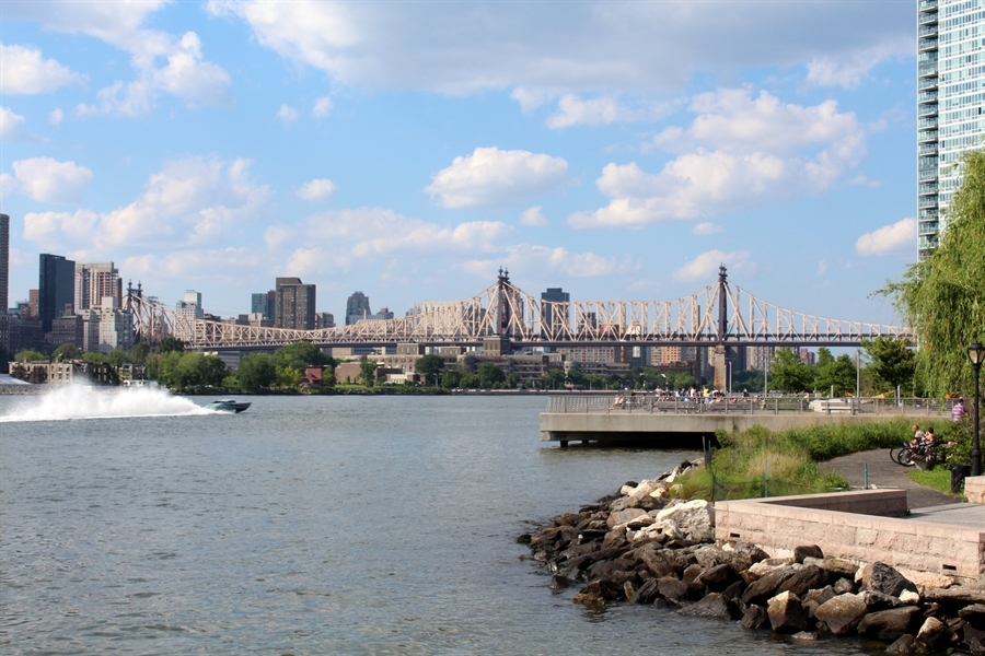
New York City, N.Y., with a population of more than 8.4 million, consists of four islands and one peninsula—520 miles of shoreline. This vast waterway system, known locally as the “Blue Network,” has been an important part of New York history; it’s one of the largest East Coast ports and a natural sanctuary for humans and wildlife. Due to this long history and the changing waterfront, the City of New York created and approved a comprehensive waterfront plan in 2011 for the next 10 years titled Vision 2020: New York City Comprehensive Waterfront Plan.
Nuts and Bolts of the Plan
The creation of the Vision 2020: New York City Comprehensive Waterfront Plan was initially mandated by the New York City Council in 2008 due to the inconsistent use and development of the waterfront. A previous plan in 1992 helped to improve the cleanliness of the waterways but did little to standardize development along the waterfront. The uneven development that sprang up over time signaled a need to reinvent the waterfront, which is where the Vision 2020plan came in. Given the successes of the 1992 waterfront plan in reclaiming and cleaning the waterfront, the Vision 2020 plan focuses on providing more opportunities for people to interact with the waterfront and the water.
The New York City Dept. of City Planning led the planning committee that consisted of leaders from a variety of government departments and advisory groups. A separate waterfront planning working group composed of leaders from civic, environmental, recreational and industrial organizations was also created to advise the Dept. of City Planning throughout the planning process.
The 520 miles of shoreline in New York City touch many different waterways both fresh and salt water including the Atlantic Ocean, the Hudson River, the Long Island Sound and the New York Bay—just to name a few. These different waterways historically and presently allow for a variety of land uses including public parks and natural, residential, commercial and industrial areas. Historically, industry in the form of manufacturing and shipping were the largest waterfront uses in New York. Understandably, that led to a highly built-up landscape that was often inaccessible and unsafe for public access. With increased public access and increased water safety brought about by previous waterfront revitalization, the Vision 2020 plan aims to make the water the “sixth” borough of New York by focusing on safe public access of the waterfront and the water.
The plan outlines eight major goals with multiple specific goals to implement each major goal. The goals are outlined below:
Expand public access
- create new public waterfront spaces
- create more connected waterfront
- ensure public spaces are high-quality, well funded, diverse spaces
Enliven the waterfront
- reinvest in the waterfront
- create incentives for brownfield cleanup and redevelopment
- increase knowledge and promote preservation and reuse of historic resources
Support the working economic waterfront
- maintain the activity at the ports and marine terminal facilities along the waterfront
- promote marine highway use to move goods
- pursue long term dredge management to ensure navigability
- strengthen maritime support services and reinvest in waterfront industrial areas
- promote environmental sustainability practices
Improve water quality
- build new and improved grey infrastructure to meet water quality goals
- maximize green infrastructure to reduce sewer overflows and other discharges
- restore natural systems
- improve monitoring and public awareness of water quality
Restore and protect the natural waterfront
- increase the protection of wetlands and shoreline habitat
- increase scientific understanding, public awareness and stewardship of natural waterfront
- promote ecological restoration to enhance regional ecosystems
Enhance the “Blue Network”
- promote water recreation
- clarify regulatory and organizational mechanisms of the waterways to ensure safety and reduce conflict
- increase waterway public transportation
- increase preparedness for waterway emergency evacuation
- increase public knowledge and awareness of waterways
- explore renewable energy on the waterfront
Improve government oversight
- improve efficiency of permitting for in-water construction
- establish design guidelines for in-water infrastructure
- ensure maintenance of City-owned waterfront infrastructure
- pursue coordination and partnership of regional issues
Increase climate resilience
- conduct citywide strategic planning process for climate resilience
- develop better understanding of city's flood vulnerability and examine strategies for increased city resilience
- explore regulatory and policy changes to increase flood and storm surge resilience
- work with FEMA and the insurance industry to collect data on risk of floods and storm surges
- assist with local resiliency planning
- integrate climate change projection into emergency planning
Planning Process
This plan builds off of the first Comprehensive Waterfront Plan in 1992, which guided a clean-up of the waterfront and improved public access. Partially due to the 1992 waterfront plan a New York City Waterfront Revitalization Program was adopted by the state, further strengthening the city’s commitment to the waterfront and expanding the “Blue Network.”
Throughout the planning process many stakeholders and public recommendations and comments were taken into account before and after the creation of the final plan. More than 400 local organizations and leaders were able to provide comments and recommendations on the overarching goals and plan through community presentations organized by the Metropolitan Waterfront Alliance, a New York City nonprofit focused on cleanliness and accessibility of the New York waterways. Nine different public meetings were organized by the Dept. of City Planning to receive feedback from all parts of the city on a plethora of topics. A separate public meeting was held in each of the five boroughs, focused on issues affecting that borough. Two centralized meetings on waterway use, urban ecology and climate resilience were held on the “Blue Network” as a system. Two city-wide public meetings were held: one to introduce the plan goals and one to review the plan draft. Along with the nine public meetings a public website was created to provide relevant information and collect comments and suggestions from individuals that were unable to attend the public meetings.
After reviewing the comments and suggestions made by stakeholders and the public the Dept. of City Planning created a 10-year comprehensive waterfront plan and a three-year waterfront action agenda. The comprehensive plan outlines the major goals for the waterfront and potential strategies and projects to achieve these goals. The action agenda presents specific projects that can be implemented within the boroughs to start achieving the eight different goals presented in the comprehensive plan. The final drafts of both documents were approved by the city in March of 2011.
Generally, the social and political feedback on the comprehensive plan was mixed with some individuals and groups reacting positively while others were skeptical about the size and scope of the plan. Politically, the City is focused on economically improving and developing the waterfront, which is reflected in the plan through the commitment to the working waterfront and the aspects surrounding it. Many members of the public are concerned about the environmental impact and the potential natural disaster damage resulting from this development so close to the water and worry that the city is too focused on development throughout the plan. Many previous projects relating to the waterfront have already been started throughout the city prior to the plan but have yet to be finished, leaving the public with little faith of the plan staying on schedule. To alleviate this skepticism the plan committee presented the three-year action agenda along with the longer-term plan; these immediate tangible goals gave politicians and the public something to grab hold of.
After the Plan
The plan calls for the New York City government to oversee the implementation of the entire plan to ensure that the projects adhere to the overall goals of the plan. Each individual project is assigned to a specific city department which will complete and oversee the implementation of the project. After the plan was approved, the Dept. of City Planning announced in a July 2011 press release that the former project director of the Vision 2020 plan would become the new director of the Waterfront and Open Space Planning division and would oversee the implementation of the plan as a whole. The new director will coordinate and manage the many departments involved to accomplish the overall plan.
Two progress reports discussing the current status of the action agenda items were released by the city six months and a year after the approval of the original plan and action agenda. The progress reports categorize the different projects into the following completion levels: completed, on schedule, progressing with delays, reconsidered and not yet started. At the one-year progress report 26 percent of the projects have been completed, 55 percent are on schedule for completion, 11 percent are progressing with delays and 4 percent have been reconsidered. The progress reports only address the items presented in the action agenda, rather than the progress toward the plan goals. The action agenda projects are the only projects throughout the plan that are explicitly tracked and their progress recorded. Progress of the entire Vision 2020 plan will be measured before the start of a new master plan in 2020.
Presently, a majority of the action agenda projects have been implemented with only a small handful needing to be reconsidered. The vision outlined in the main plan is still held as a priority even with the change in mayoral administration. One of the major projects resulting from the plan is the expansion of the ferry service to all five boroughs. The unexpected arrival and destruction of Hurricane Sandy in 2012, soon after the release of the plan, reinforced the need for a commitment to climate resilience, resulting in a larger focus on the last major goal of plan. New York City has committed to making the waterfront a priority and improving it through the Vision 2020 waterfront plan and future plans.
Lessons for Chicago
Strengths
- presented a significant amount of background information that supports the goals and recommendations proposed
- built off successes of 1992 plan
Weaknesses
- proposed a large number of projects with a lot of moving parts
- limited discussion of funding sources
Implementation Strategy
- presented unclearly in the plan and seems disjointed because many departments are relied on to implement the plan
Outcomes
- presence of action agenda items led to immediate measurable results
- published progress reports on the status of the action agenda items
See what other cities we're studying.